Explore the area
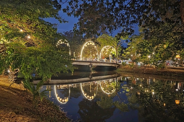
The Siem Reap River divides the central Old Market quarter from the Art Center Night Market side. Bridges, trees and market streets make this a useful short walk at sunset and after dark.
Visiting advice
- Start before sunset to recognize crossings in daylight.
- Use lit public paths and avoid river edges without barriers.
- Allow approximately 30–50 minutes with photo stops.
Highlights
- Views toward both banks and the Old Market quarter
- Pedestrian crossings that link two market experiences
- Evening reflections, street trees and a change of pace from Pub Street
About this place and its management
The river corridor is public urban space rather than a single ticketed attraction. Roads, footbridges and riverside maintenance are matters for the relevant Siem Reap public authorities; individual riverfront businesses operate separately. Observe local access notices.
For visitors combining Phsar Chas and the Art Center Night Market, the river is both a navigation landmark and a place to pause for photographs. This route is an editorial suggestion, not an officially waymarked trail.
Visitor information
- Address
- Siem Reap River, Old Market riverside, Krong Siem Reap, Cambodia
- Opening times
- Open public paths subject to local access
- Admission
- No general riverside admission
Schedules and access may change; check on site before travelling.
How to get there
- Central Siem Reap is best explored on foot for this short segment.
- For mobility needs, check curb ramps and bridge conditions before beginning.
- Arrange a pickup on an accessible road away from bridge bottlenecks.
History and local context
The river has long shaped the central town’s geography and trading streets. Modern riverside improvements and bridge arrangements have evolved; verify current pedestrian access rather than assuming old maps are exact.
Architecture and surroundings
Observe the different bridge forms, river edge treatments and clusters of shopfronts. Public infrastructure and informal street life are the main built features of this route.
Culture and experience
The riverside connects commuters, traders, walkers and evening visitors. The waterfront atmosphere differs between busy bridgeheads and quieter stretches.
Suggested walking route
- 1Begin at the Old Market river edge.
- 2Use an open public bridge to reach the opposite bank.
- 3Browse the Art Center area, then return across a safe marked crossing.
Photography viewpoints
- Frame the bridge with both riverbanks visible.
- Try reflections shortly after sunset without blocking pedestrians.
- Photograph skyline and illuminated market edges from safe public viewpoints.
Where to stay nearby
Riverside and Wat Bo accommodations can provide convenient access to both banks; check actual walking routes and overnight noise.
Visitor perspectives
Schedules and access may change; check on site before travelling.
Google Maps ↗Frequently asked questions
Is this a signed walking trail?
No. It is a suggested public-street walk; follow live maps and local signs.
Can you walk after dark?
Use well-lit open public routes and assess conditions on site.
Does the route include the same market twice?
No. The Old Market and Art Center Night Market are on opposite banks.
Directions and map
Siem Reap River, Old Market riverside, Krong Siem Reap, Cambodia
View this exact place on Google Maps ↗